
Our greatest glory is not in never falling, but in rising every time we fall!
Confucius
Mount Whitney, a majestic Fourteener is one of the most famous trail of US. It is the highest peak in the contiguous United States. It has been a milestone for thru-hikers, backpackers and day hikers alike. With its towering presence and rich natural beauty, Mount Whitney offers an unparalleled hiking experience that will leave you breathless, both figuratively and literally.
And my plan for Mount Whitney? Well, it all started with a message from an avid trekker friend Hanmanth way back in start of year.

Yes, you will have to plan quite early. If you think, getting trained for the hike is hard, getting permit for Mount Whitney hike may be even harder. Reason being the success rate of getting permit has been less than 30%. A group of like minded hikers joined the group and applied for the permit.
Visit the Whitney permit lottery page for up to date information on the application dates, process, and links.
Finally few of group members got lucky, and I got a slot in Suryakant, the lottery winner.
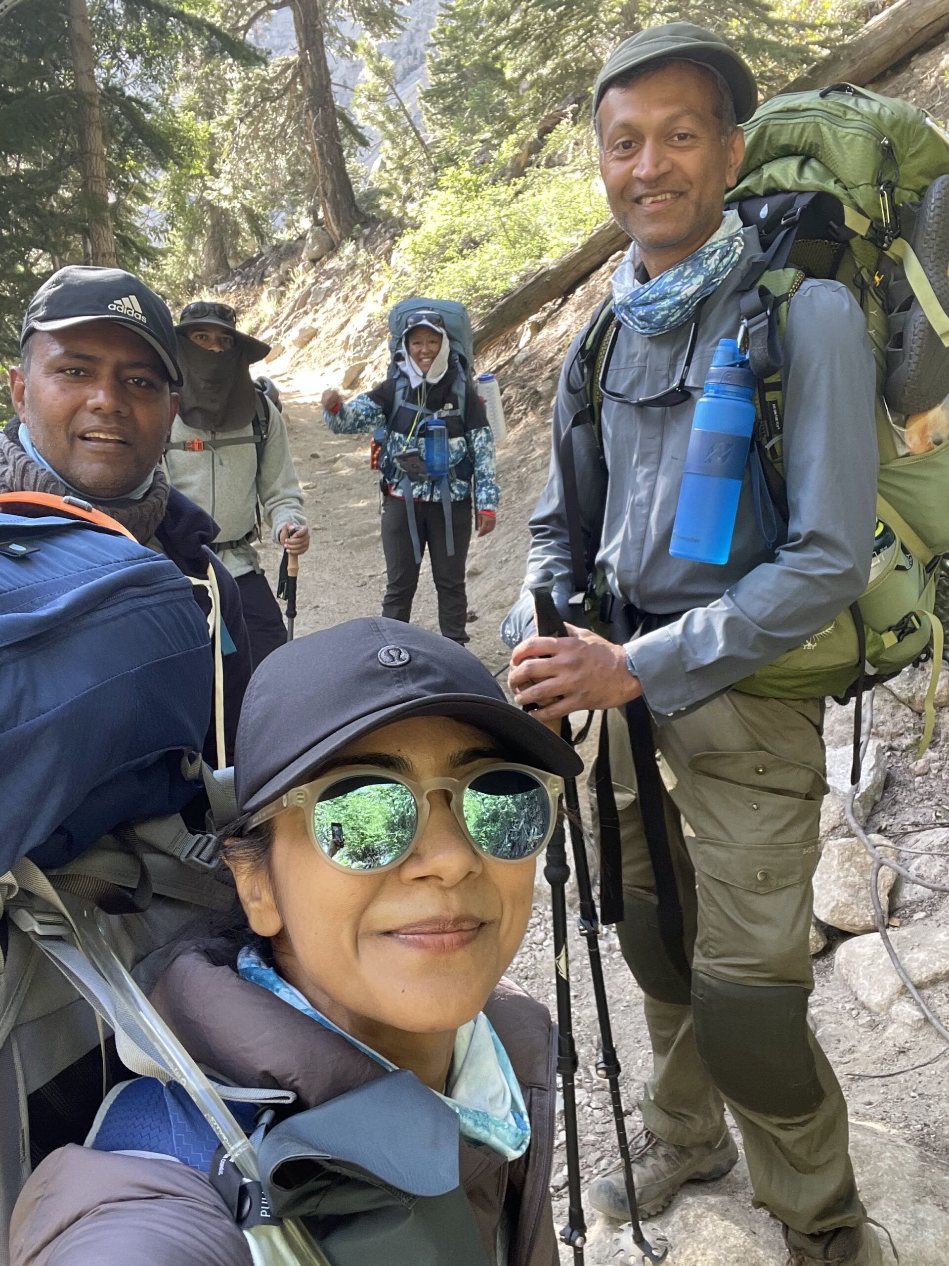
Team
Sury, Suryakant

Ritesh

Neha
Archana

Myself

Trail Map
The trail route to Mount Whitney summit offers breathtaking beauty and awe-inspiring views. The plan was to stick to the standard map.
Water Resources
We were aware of the available water resources en route to summit, thanks to wonderful resource at this page. Following table is recreation from that site.
| Location | Miles | Elevation | Comments |
|---|---|---|---|
| Carillon Creek stream crossing | 0.5 | 8600 | From the slopes to the north |
| North Fork LP Creek stream crossing | 0.6 | 8800 | From Lower Boy Scout Lake |
| Cascade by downed log, below LP Lake | 2.5 | 9900 | Stream from Bighorn Park |
South side of Bighorn Park | 3.7 | 10360 | Spring from the north slopes of Candlelight Peak |
| Outpost Camp | 3.8 | 10360 | From Trailside Meadow |
| Outpost Camp | 3.9 | 10360 | From Mirror Lake |
| Outlet of Mirror Lake | 4.3 | 10640 | Can have minor organic matter late in the season |
| Stream from Trailside Meadow | 4.8 | 11150 | In spring and summer, most comes from Consultation Lake |
Trailside Meadow | 5.3 | 11390 | Later in the season, most comes from the Trail Camp area |
Consultation Lake | 5.8 | 11700 | Actually, off the trail to the south |
| Trail Camp Pond | 6.3 | 12040 | Next to Trail Camp |
| Stream feeding Trail Camp Pond | 6.4 | 12040 | Just west of Trail Camp Pond |
| Spring near Switchback #23 | 6.7 | 12400 | Usually flows late May to September; may freeze at night |
Carry your filters, and plan accordingly. Our plans were to carry a bottle till trail camp (as we can get it refilled along the way), and then carry at least 4 liters from trail camp to summit.
Whitney Portal

The trail begins at the Whitney Portal Trailhead, located at an elevation of 8,360 feet (2,548 meters). Its a historic trailhead named after Josiah Whitney, a 19th-century geologist that has welcomed countless hikers and mountaineers over the years.
We woke up early on a clear morning and drove to the Whitney Portal trailhead. The parking lot was already filling up with other hikers, all eager to start their day on the trail. We shouldered our backpacks and set off on the trail that winds its way through diverse ecosystems and elevations, ultimately leading to the summit of Mount Whitney.
In order to avoid a creek on the way (around half a mile from Portal head), Ritesh had plans to go via the nearby alternate route.
Lone Pine Lake
As we set off, the crisp mountain air filled our lungs, invigorating us for the challenges that lay ahead. The trail was well-maintained and easy to follow, but the elevation gain was starting to take its toll. We took a few breaks along the way to catch our breath and admire the views of the Sierra Nevada.


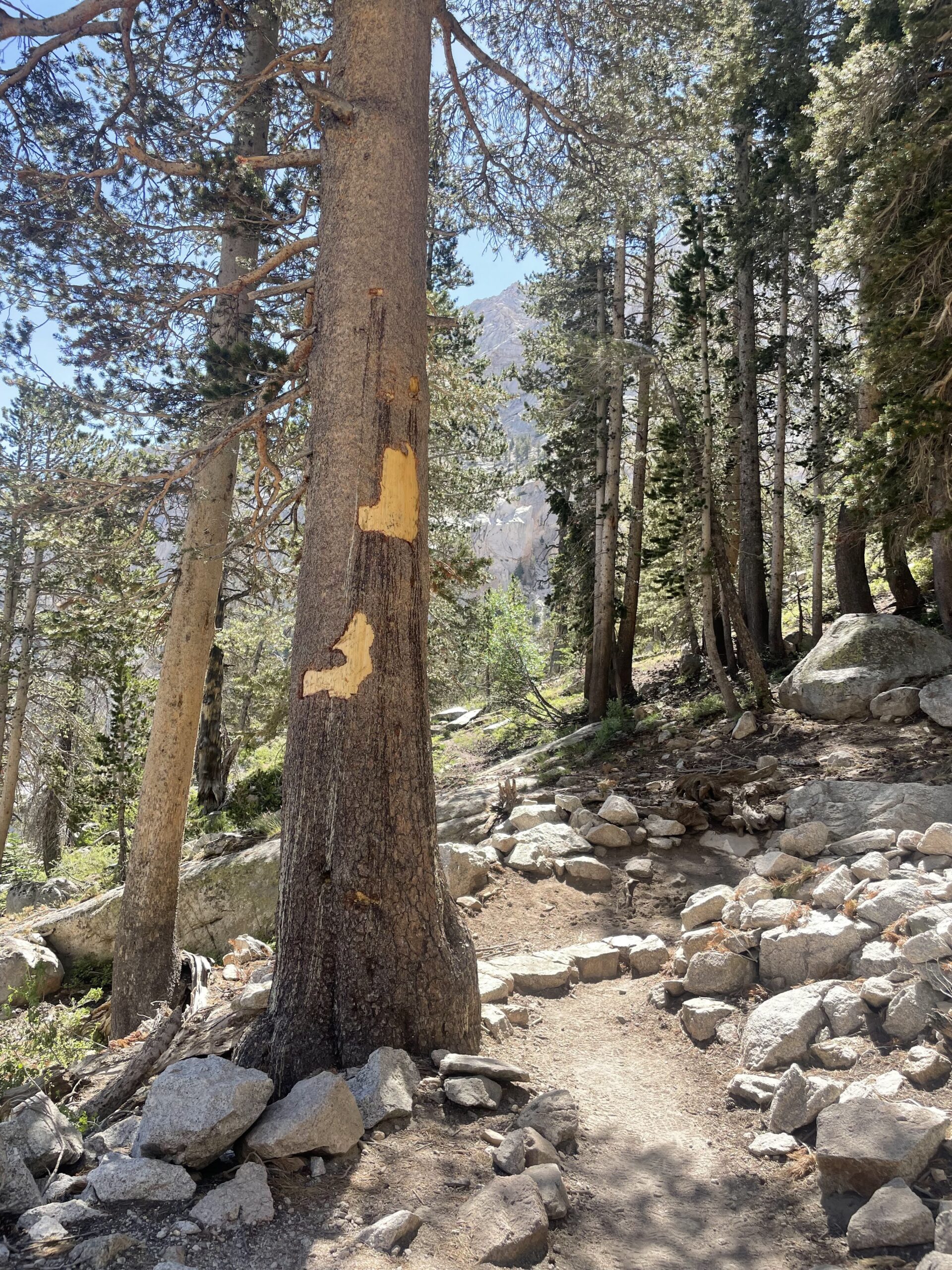
Some of the trees in trail contain these marks, which I assume are marker to keep hikers on right trail
En route to Trail Camps, hikers first encounter the pristine Lone Pine Lake. Nestled amidst towering granite peaks and fragrant pine trees, this alpine oasis offers a tranquil respite along the trail. The shimmering waters mirror the towering peaks and provide a glimpse of the beauty that lies ahead.

However since we have already refilled our water, we made a pass at Lone Pine Lake.
We witnessed couple of Creek, and this one in particular crossing of Lone Pine Creek is interesting because it is accomplished by walking the length of numerous logs that cross a very wide area that would otherwise be a year-round wet crossing.

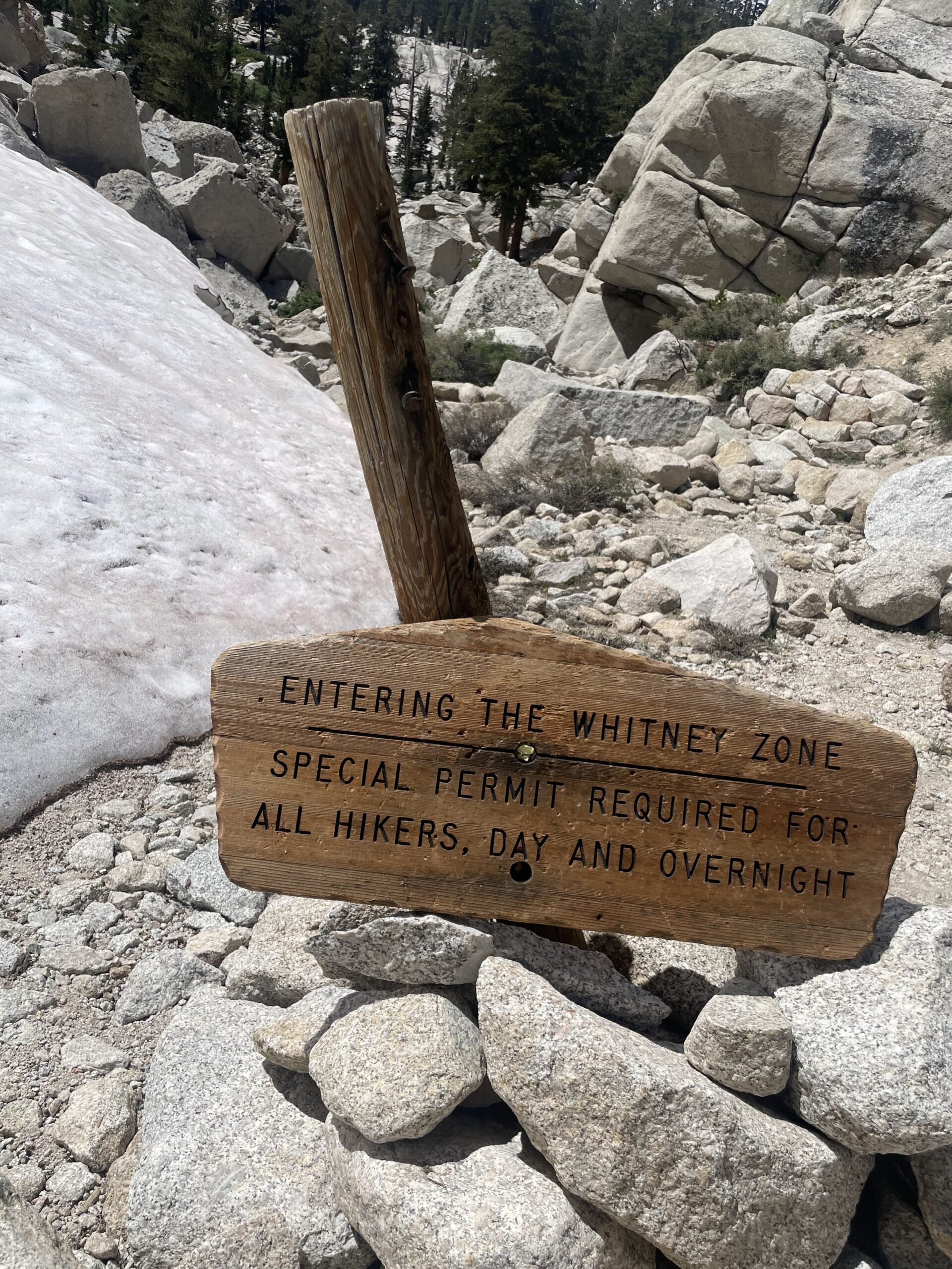
Further climb up from Lone Pine Creek, we reached the sign marking the boundary of the Whitney Zone.

The snow patches started coming closer to the route, but route was still clear of snow.
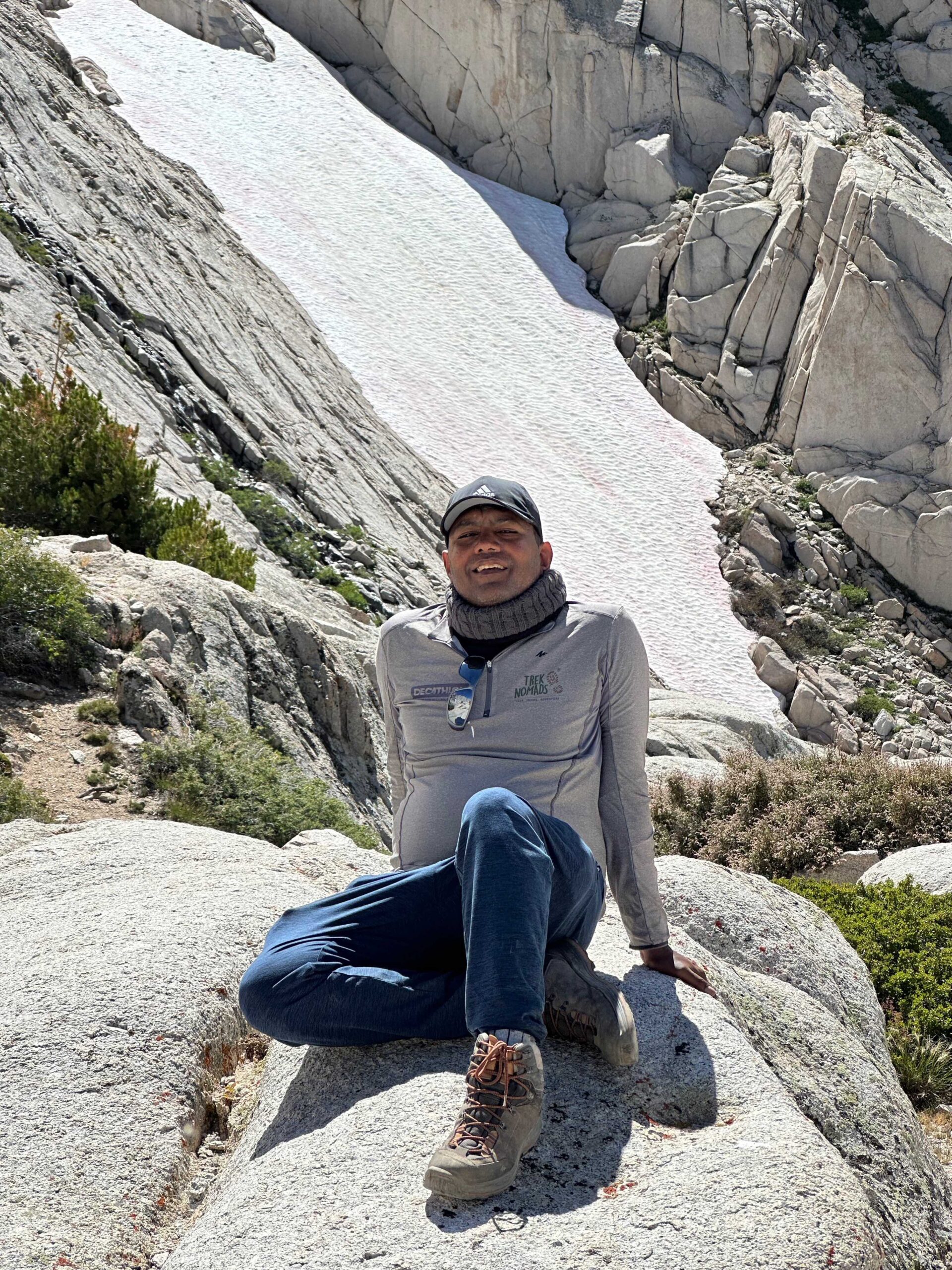
T-Shirt sponsored by my friend Naveen, who runs TrekNomad, a hiking company. Visit their website, for their range of hikes from Everest Base Camp, Himalayas, Vietnam, Kilimanjaro and across world.
The next mile from Whitney Zone to Outpost Camp will have couple of switchbacks with tree coverage.


Outpost Camp
And we reached at Outpost Camp, which is 3.8 miles from the Whitney Portal trailhead at around 10,300 feet (3,139 meters) altitude. The camp offers spacious areas for resting and camping, surrounded by majestic alpine meadows and towering peaks. It is still below tree line with campsites sheltered by trees. There is also a stream running through it to provide a water source.
If you have decided to camp at Outpost Camp, remember that it is farther from the summit than Trail Camp. So if you choose to hike directly to the summit from here, you will have a longer day. But it makes a great camp to sleep lower and acclimate to altitude.
The campground provided a perfect spot for lunch break. The chai lovers could not have waited for more.


Soon after the tea break, we continued on the trail, which began to climb more steeply.

In the stretch from Outpost to Meadows, we witnessed watermelon snow. It occurs when a bacteria called psychrophilic begins to grow in cold environments, according to a study published by the National Library of Medicine. Algae is the source of the bacteria and that’s what turns patches of snow a pink or red hue.

Needless the repeat, the beauty en route again was mesmerizing.


And meadow indeed is a very beautiful spot with stunning view. Trail Meadows, with its vibrant wildflowers and expansive views, was a testament to nature’s grandeur.

As we cross the meadow after a couple of switchback, we encountered our first snow on route, which was slippery and challenging to navigate. Ritesh and Suri had to help others to get through the patch safely.
As we walked towards the Trail Camp, along the way, we passed by Consultation Lake which still had snow patches.

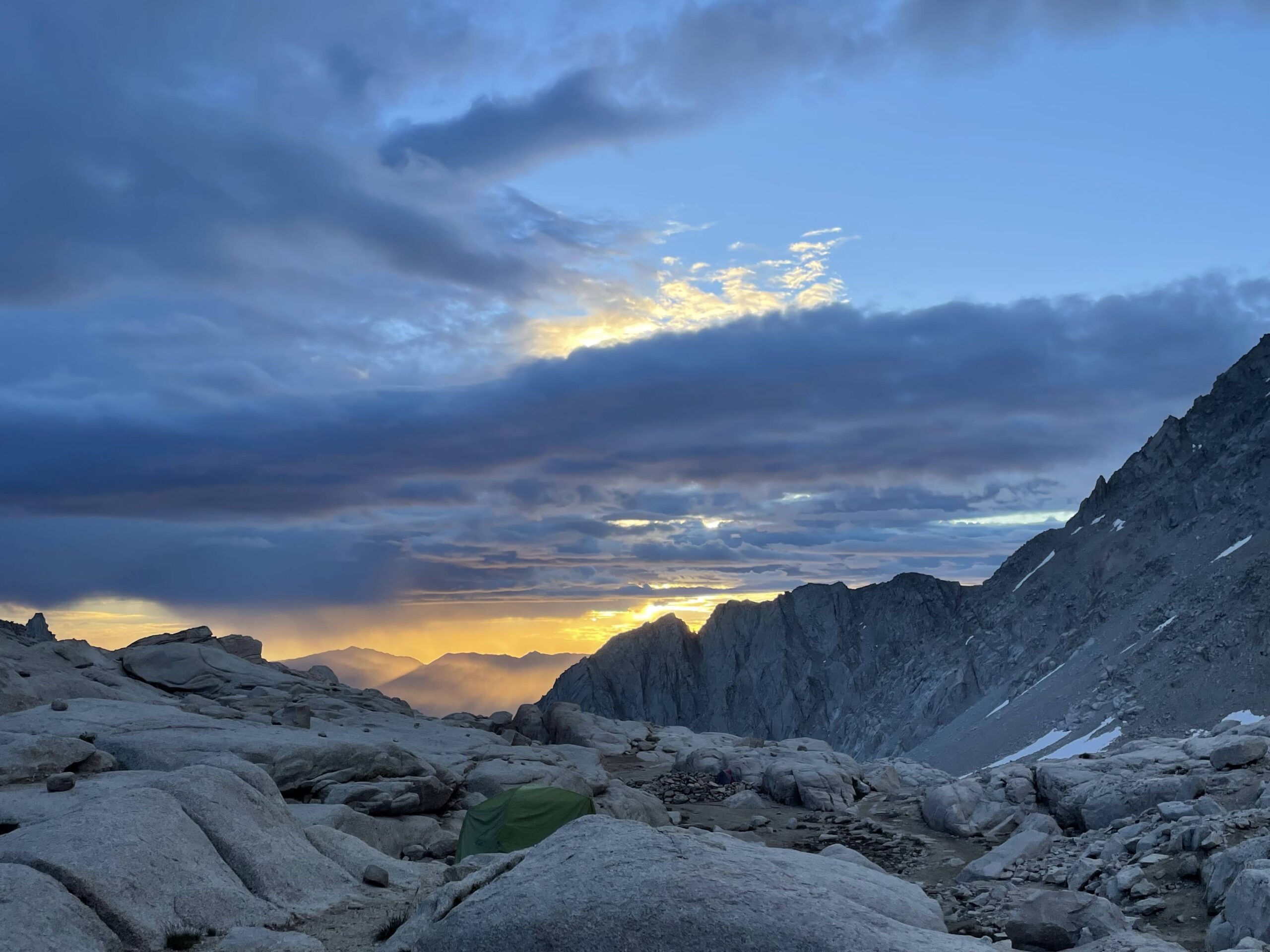
Soon Trail Camp was in sight. Sury was first to reach Trail Camp and was waiting for us. Rest of us were walking cautiously and slowed down as Trail camp was going to our stop for the night. As we reached the trail camp, the thinning air began affected us differently. One of our friends started experiencing symptoms of altitude sickness, a stark reminder of the challenges posed by the elevation gain.
Altitude sickness, caused by the decreased availability of oxygen at higher altitudes, can strike even the most seasoned hikers. It’s a reminder that nature’s beauty and challenges often go hand in hand.
Archana and Neha, did tremendous job with food and soup, so that they symptoms of Altitude Sickness is reduced. The unwavering support and care of them made all the difference. They also helped to setup tents.
As morning sun rises we faced the dilemma of whether to continue or descend to lower altitudes. It was a tough decision, as our shared goal of reaching Mount Whitney’s summit was within reach.
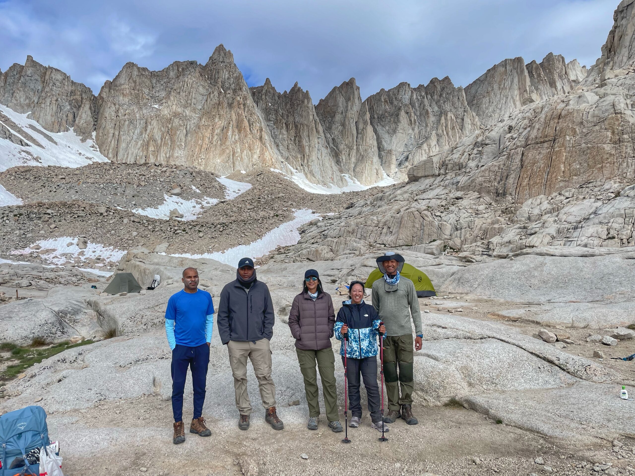
We made the difficult choice to turn back and descend to a more comfortable elevation. Since we were not going to proceed, we had some time before our descent. Sury utilized the time to go a bit further up.
Once he was back. we started to retreat after a group picture. The view of Mount Whitney from Trail Camp is incredible. The mountain looms large in the distance, its summit capped with snow.

While our journey didn’t culminate in standing atop Mount Whitney, it was a lesson in the unpredictable nature of high-altitude adventures. It’s a reminder that the mountain, while a symbol of achievement, also demands respect and an awareness of our physical limitations. This experience underscored the importance of preparedness and the unpredictability of altitude’s effects on the human body.
As we returned to Outpost, a mix of emotions washed over us – a sense of accomplishment for making it as far as we did, and a newfound respect for the challenges posed by the altitude. And then Sury and Neha came with the plan of the Maggi, the national noodle of India 🙂

Chai, Maggi and a power nap. We spent our time in the most relaxed way.
While our attempt to conquer the Mount Whitney trail might not have ended at the summit, it was a journey that left an indelible mark us. The mountain, with its towering peaks and unpredictable challenges, taught us the value of humility and the importance of listening to our bodies. Our decision to turn back before reaching the summit was a reminder that nature’s power and our own limitations are intertwined inextricably. As we retraced our steps, leaving behind the lofty heights and thin air, we all had this pledge to return back. Insha Allah.

- India
- World
- Live
- Cricket News


